Portola Valley · California
Windy Hill
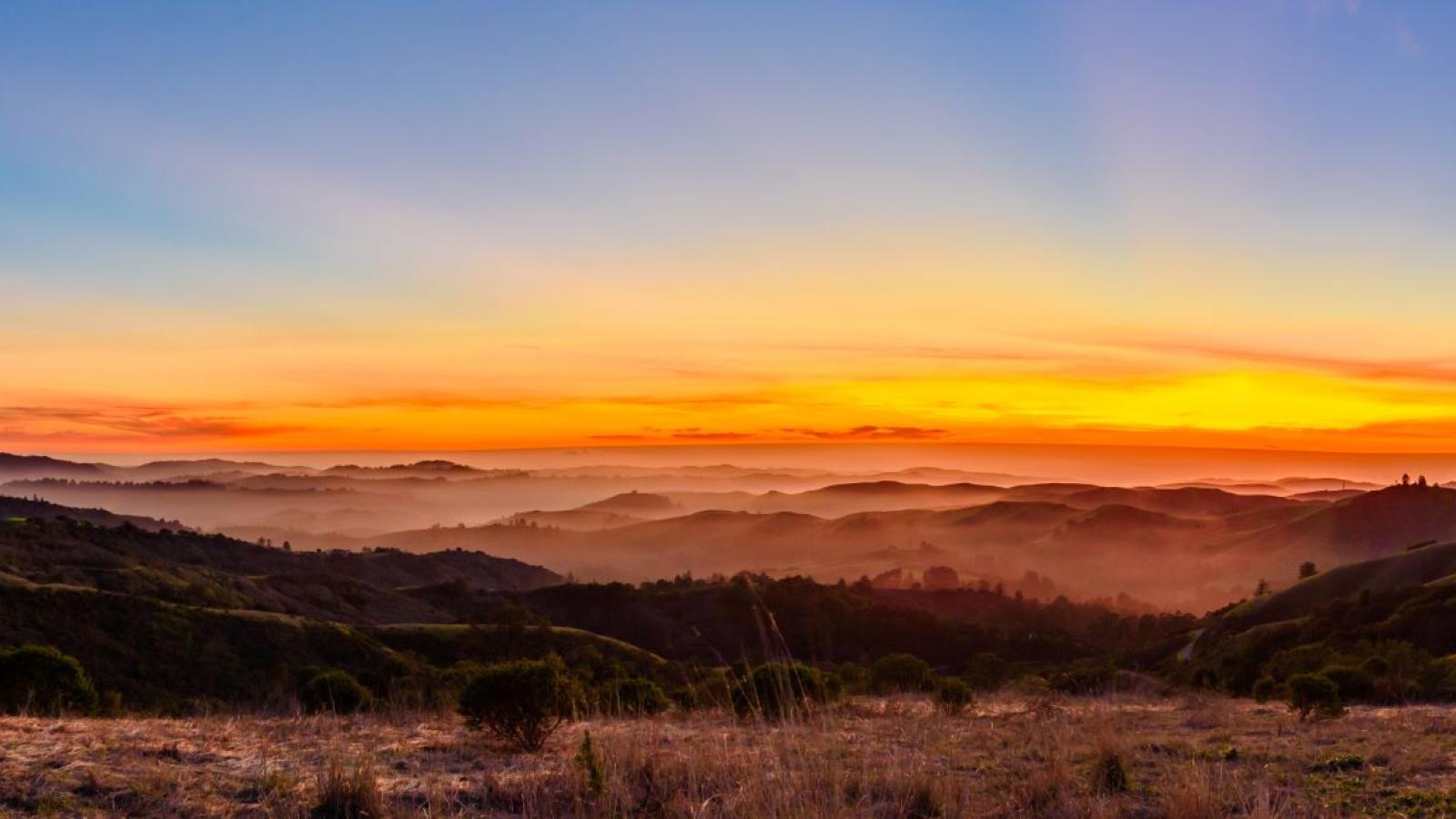
Where the peninsula runs out of trees. A bald gold ridge that keeps the wind, holds the light, and hands you the whole world at once - the Bay on one side, the Pacific on the other.
The one bare hilltop you can pick out from the whole valley floor
Most of the Skyline ridge wears a thick coat of redwood and fir. Windy Hill takes it off. Its summit is grass and sky and nothing else - the only truly bald shoulder on this stretch of the peninsula, which is exactly why you can spot it from the South Bay flatlands, a pale gold dome floating over everything green.
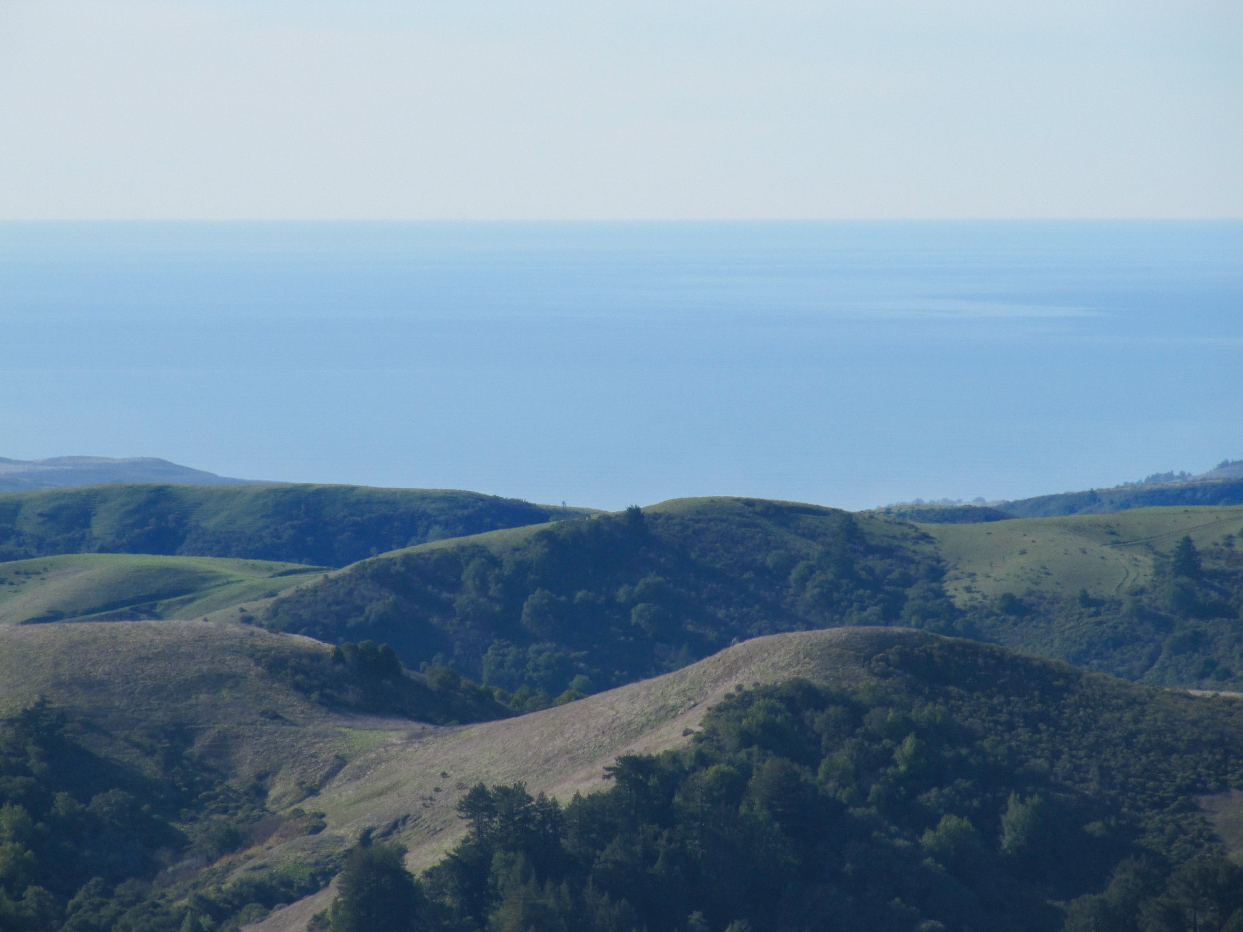
Underneath that famous summit sit 1,414 acres of country that changes character as you climb: oak woodland and wildflower meadow down low, chaparral on the open slopes, cool forest of redwood and fir in the gulches. The wind is always working the top of it. That is the whole appeal.
The preserve is cared for by the Midpeninsula Regional Open Space District, and its story is a founding one for Bay Area conservation: Windy Hill was the very first land the Peninsula Open Space Trust ever protected, back in 1981. Recognized as a significant addition to Midpen in 1980, it grew with a major 429-acre purchase in 1987.
Tucked into the Skyline ridge, a half-hour from almost everywhere on the peninsula
Windy Hill straddles the east side of Skyline Ridge above Portola Valley, California 94028, in San Mateo County. Highway 35 - Skyline Boulevard - runs the top of the preserve; Portola Road traces the bottom. The lower trailhead is an easy reach from Palo Alto, Menlo Park, and the rest of the South Bay - roughly thirty minutes up from San Jose.
Skyline Blvd (Hwy 35)
Portola Road
Palo Alto · Menlo Park
Pick a trail by how much hill you want
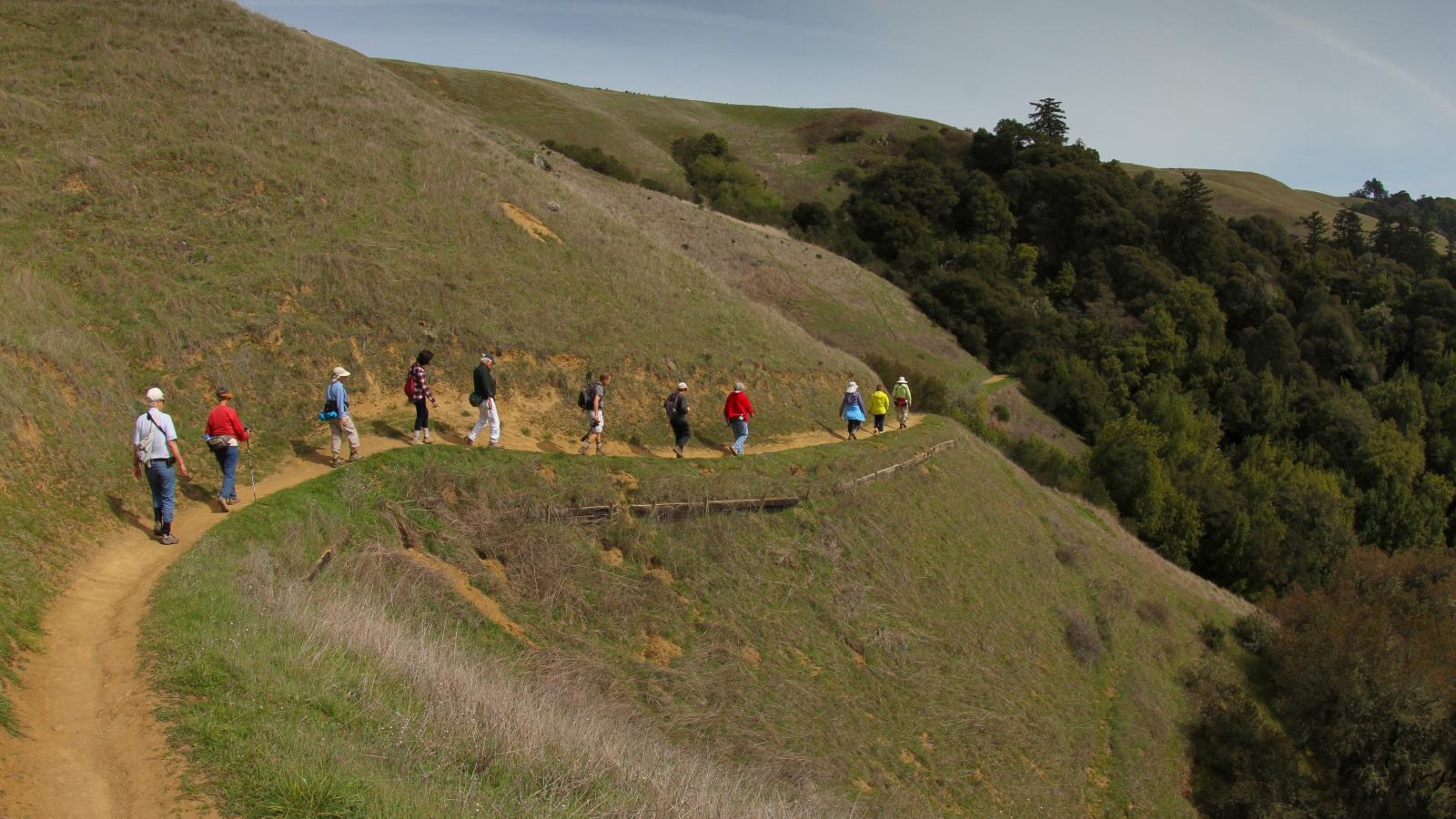
Roughly fourteen miles of trail fan out from the ridge - some open to mountain bikes, horses, and leashed dogs. From a half-mile stroll to the summit to a strenuous loop of the whole hill, here is the lay of the land.
- 01
Anniversary Trail
The shortcut to the view. A short ridgetop walk between the two upper Skyline lots, with quick detours to the Windy Hill summit and the Herb Grench overlook - and the full 360-degree panorama of both the Bay and the Pacific waiting at the top. Built in 1987 to mark the Peninsula Open Space Trust's 15th anniversary and Windy Hill's first five years as open space.
- 02
Sausal Pond Loop
A gentle, all-skill-levels wander through oak woodland and grassy wildflower meadows down to Sausal Pond, where egrets, blue herons, wood ducks, dragonflies, and the western pond turtle keep house. Leashed dogs welcome. Stay on the designated trail - the pond's edge is fragile.
- 03
Windy Hill Loop
The whole hill in one go. Stitch together Spring Ridge, Lost Trail, and Hamm's Gulch past Sausal Pond and up through oak woodland, chaparral, and meadow to the iconic bald summit - where, fog permitting, the Bay and the Pacific show up in the same glance. A long, rewarding day.
- 04
Spring Ridge Trail
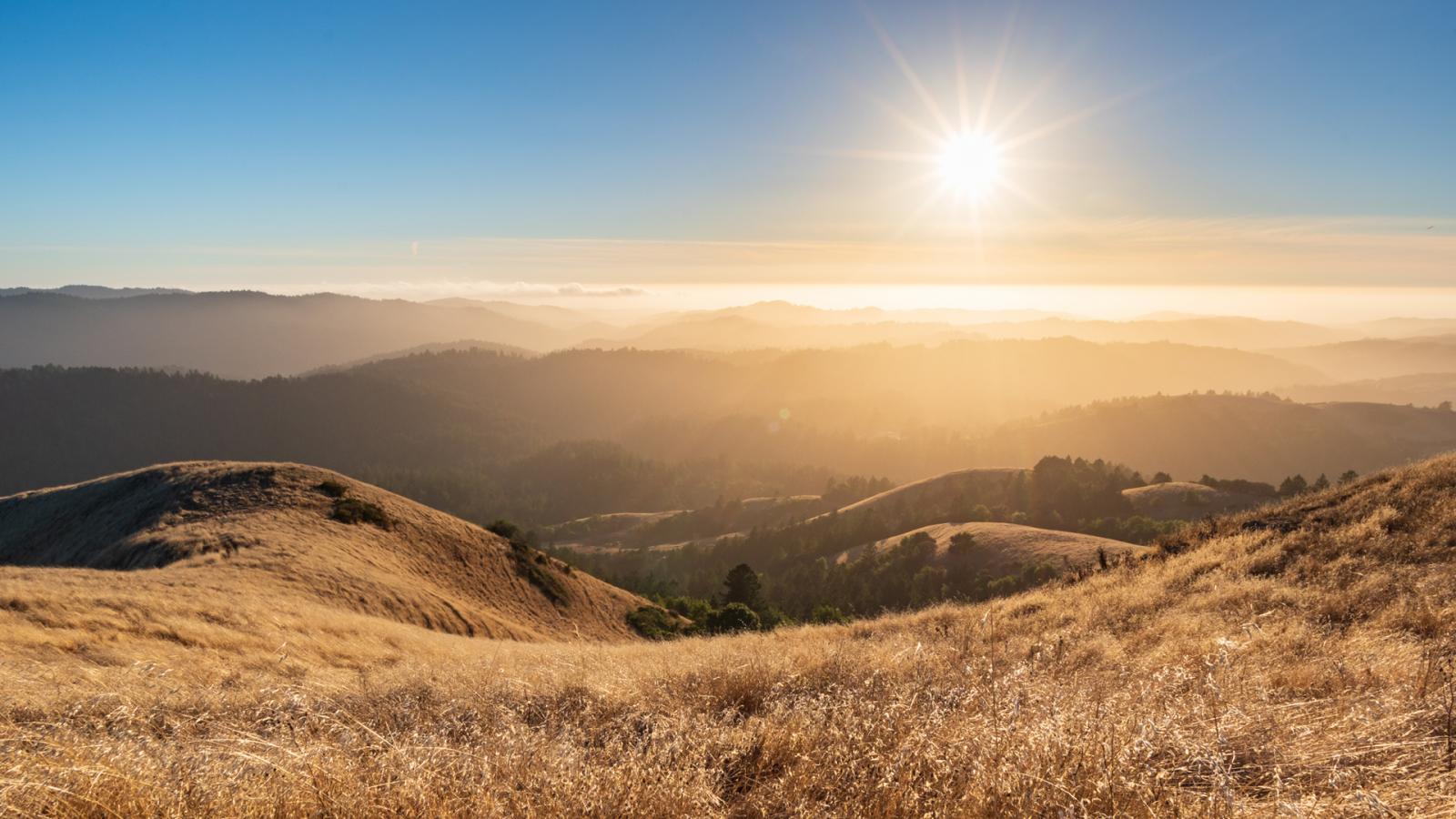
The sunny side. A broad, steady climb straight up the open grass with nothing between you and the sky - gorgeous, breezy, and genuinely hot in summer. Most hikers save it for the descent (it's all downhill that way) or for a sunset push to the top.
- 05
Hamm's Gulch Trail
The cool side, and the local favorite for going up. A forested, well-graded climb through redwoods and creekside woodland that stays shady when the ridge is baking. Pair it with Spring Ridge and you've walked both faces of the hill.
- 06
Razorback Ridge Trail
The path fewer people take. Razorback and Lost Trail thread the forest to link the loops - shaded, quieter, and the makings of the longer Razorback-to-Spring-Ridge loop: about 9.5 miles and 1,300 feet of gain, moderate to strenuous.
Stand on the bald summit and the whole coast turns to face you
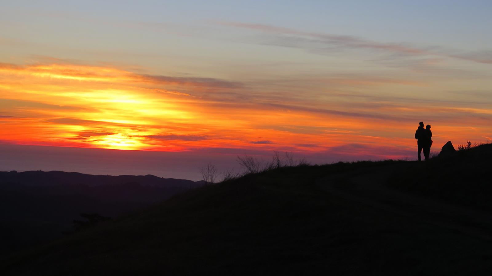
A true 360 degrees. To the east, San Francisco Bay and the South Bay flatlands lay out flat and shining; to the west, fog permitting, the Pacific. Come for sunrise or stay for sunset - this is one of the peninsula's most beloved places to watch golden-hour light pour over the bay and across the emerald hills after the winter rains.
Four habitats stacked up one hillside
Oak woodland, redwood and fir forest, chaparral, and golden grassland meadow - all on a single climb, all lit up with wildflowers in spring. Down at Sausal Pond, watch for egrets, great blue herons, wood ducks, dragonflies, and the western pond turtle, a California species of special concern. Up on the open ridge, red-tailed hawks ride the thermals while deer move through the grass. Midpen is even studying American badgers and burrowing owls in the area.
Naturally occurring residents to respect
Rattlesnakes (out in warm weather), ticks, and poison oak are part of the landscape, and mountain lions pass through. Stay on trail, give wildlife distance, and you share the hill just fine.
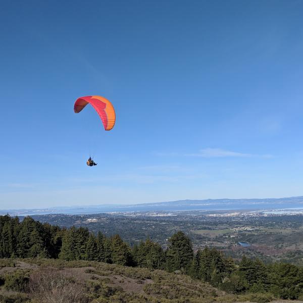
A favorite place to fly
That dependable wind makes Windy Hill a northeast-facing paragliding and hang-gliding site - flown by permit through the Wings of Rogallo club - and one of the best spots around to put up a kite.
Early, and ideally in spring or at golden hour
Spring, March through May, is the show - wildflowers and hills gone lush and green after the rains. Summer trades green for that classic California gold and a low, warm light that the bare summit drinks up. Whichever season, start early: the ridge is exposed and shadeless, the preserve warms up fast, and the lower lot fills by mid-morning. Weekend mid-morning to early afternoon is busiest; early morning and evening are yours.
Spring · Mar - May
Wildflowers and the greenest hills, right after winter rain.
Summer · gold grass
That sun-bleached glow and long golden-hour light over the bay.
Go early
Cooler trails, easy parking, and the hill nearly to yourself.
Sunset on Spring Ridge
A local ritual - climb the open grass into the last light.
The practical stuff, so the day goes smoothly
Difficulty & elevation
- Easy on the Anniversary Trail and Sausal Pond Loop.
- Strenuous on the full Windy Hill and Razorback - Spring Ridge loops.
- The full loop climbs ~1,300 ft; the summit sits near 1,900 ft, about 1,300 - 1,400 ft above the lower trailhead.
Parking
- Lower lot: Portola Road, 47 spaces + 2 ADA - fills quickly.
- Do not: park on Portola Road (strictly enforced).
- Overflow: Portola Valley Town Center, ~0.4 mi north, then take the Portola Trail in.
- Upper (Skyline): Spring Ridge (10), Picnic Tables / Anniversary (11 + 1 ADA), Razorback (6), Willowbrook - Alpine (4).
Hours
- Open a half-hour before sunrise to a half-hour after sunset, every day.
Dogs
- Welcome on leash on designated trails only.
- Six-foot leash, up to three dogs per person.
- Pack out all waste.
Bikes
- Designated trails only; helmets required.
- 15 mph limit. E-bikes generally not allowed.
Water & facilities
- Restrooms at the trailhead. No drinking water - bring your own.
- Plan about 2 quarts per person per 2-hour hike.
- Cell service is sporadic. Picnic tables near the Spring Ridge lot; free maps at the Portola entrance.
Leave no trace
- Pack out everything you pack in - most preserves have no trash cans.
- No fires, no smoking, no drones, no swimming or wading.
Address & contact
- Portola Valley, CA 94028.
- Managed by: Midpeninsula Regional Open Space District.
- Main office: 650-691-1200.
So go up the hill, into the wind and the gold
Bring water and an early start. Climb until the trees fall away and the grass takes over, until the Bay opens on one side and the ocean hides somewhere under the fog on the other. Let the wind do what it has always done up here. The hill has been waiting since 1981. Today's a good day for it.